Sunday, October 28, 2012

Sunset on the Chesapeake Bay, and the Chesapeake Bay Bridge-Tunnel

Tuesday, October 23, 2012

After leaving Chincoteague, we needed a place to sleep.  No reservations for the night!  I had tried, unsuccessfully, to book a night at a B and B that sounded lovely. It sat right on the Chesapeake Bay and promised a gorgeous sunset. We couldn't get in, and I was so disappointed that I quit looking.  We had to 'wing it."

Our drive continued south on Rt. 13, and we vowed that we wouldn't cross the Chesapeake Bay Bridge-Tunnel until the next day, so we could see where we were going.  We thought we'd find more chain motels along the way than we did.

A side jog through the small town of Cape Charles, Virginia, had me mentally purchasing real estate and moving there.  What a quaint little place!  Their water tower looks like a huge lighthouse.  The town is full of bed and breakfasts, galleries and shops, and the Chesapeake Bay was right there at the town's edge. Without a reservation, there was no way to get into one of those B and B's, we had already found out.

When we had entered Virginia, a lovely hostess at the state's welcome center told us of an older motel right before the bridge.  We really didn't think we'd get that far without finding a place, but guess what?  That's where we ended up!

The Sunset Beach Resort has seen better days. Actually, using the word "resort" is sort of pushing it.  We could see that there had been a huge convention area,  dining rooms for business dinners, and some time ago it had been a shiny, new resort.  Sometimes ya just have to look beyond the facade, and really look at the potential, and that's what we did at the Sunset Beach Resort.

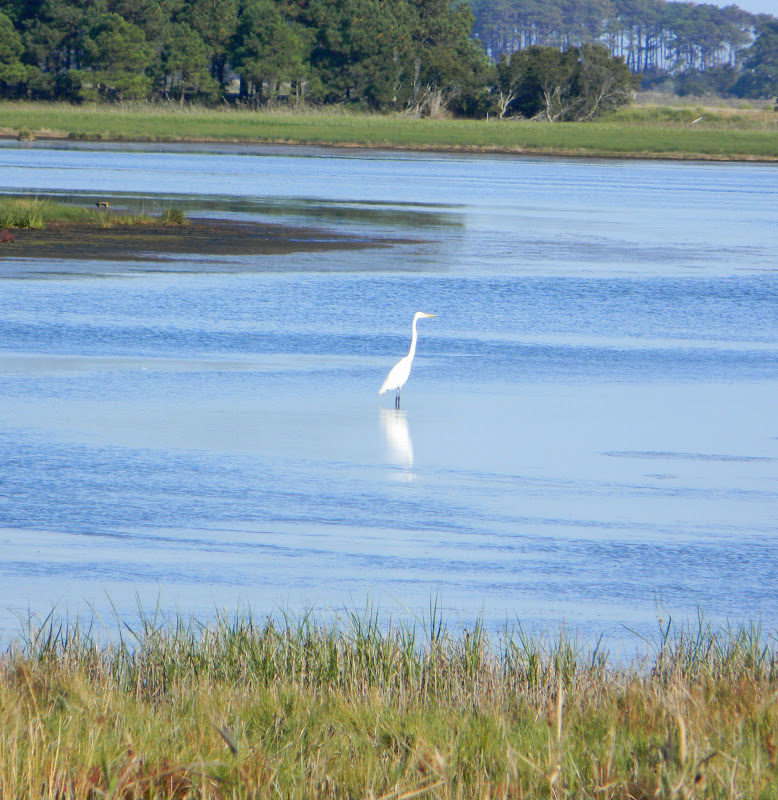
An enormous field of newly cut grass separates the motel from the Chesapeake Bay. A football team would be happy with that field. A small, private restaurant sits right on the bank of the Bay, on the other side of that grassy field. The Sunset owns the restaurant, and hosts receptions and parties there, but it was closed this night.

Our room was on the second floor overlooking that big field and we could see the Chesapeake Bay from our front window.  The room was clean and basic, but it was rented to us by "Bill," a nice guy who was happy to accept the last quart of soup from the Soup Swap from me, since we would have no refrigerator.  He also let us use the microwave in the small breakfast kitchen near the lobby, so we could heat up the next-to-last quart of soup, which we enjoyed for our dinner.

But before we unloaded our bags or ate our soup, we drove the car down to the Chesapeake Bay and watched our own private sunset.  We didn't need the pricey B and B.  We had the most gorgeous and colorful farewell to a day that we have ever seen together. Enough with the words.  I wish the photos could do it justice.


We set the camera on a table to shoot a picture, then sat and ooohed and ahhhhed over the colors of the sky.  A fisherman and his dogs came by, and a woman who runs a shell shop pulled her car into the lot and ran up and down the beach, collecting dead horseshoe crabs.  She told me that she gets a dollar each for them.  I pictured myself setting up a stand...........

We sat there until it was very dark, then went back to our room and slept like people who hadn't seen wild horses, but  had seen a fabulous sky.

In the morning, we went back to the shores of the Bay to enjoy the beach a bit more, shoot some pictures of the Chesapeake Bay Bridge-Tunnel from the shore, and enjoy the sunshine.  I resisted the urge to gather up a bag of dead horseshoe crabs, but did select a few choice pieces of driftwood, a few shells, and some smooth stones.  These were keepers.

Following our motel breakfast, we drove the short distance to the bridge entrance, paid the $12 toll, and drove for twenty miles across the Chesapeake Bay Bridge-Tunnel. Some of this time was spent underwater, as there were two tunnels to go through. I am talking about tunnels that go under the water. It is actually twenty-three miles, if you add the approach roads to it.

This may be one of the most amazing experiences of my driving life. Twenty-three miles is as far as from my house to my friend Jane's...........and she lives several towns away from me.  We thought the toll seemed a bit steep, at first.  We knew it was a long bridge.............but until we'd completed this amazing ride...........who knew?  The Chesapeake Bay Bridge-Tunnel was opened in 1964.  It has been called one of the "Engineering Wonders of the Modern World."  I would vote for that.  To even imagine building a bridge-tunnel that long to connect Cape Charles, Virginia to Virginia Beach, Virginia, had to be the dream of a true visionary.

Once over the bridge, it was all "Get to the Beach" driving. The sun was shining. It was in the high seventies, and we had no need to stop at places along the way, except for lunch, which was at a Captain D's somewhere along the way............huge butterflied shrimp with fries, served with cole slaw and a full squeeze bottle of cocktail sauce. Divine hush puppies adorned the plate.

We had a reservation for a full week at an oceanfront motel in Kill Devils Hills, directly across from the Wright Brother's Memorial, which could be seen from the motel's parking lot.

We arrived, sat on the beach and read wonderful books.  Dinner was plate of calamari and drinks at Awful Arthur's, which has been a favorite of ours (and everybody else's) since we started going to the Outer Banks together. 

Randy commented several times about how "placid" the ocean was.  The waves were calm and there was hardly a breeze.

What possibly could keep this from being a perfect week at the beach?


Thursday, October 25, 2012

Ocean City Maryland, Chincoteague and Assateague


October 22, 2012

Having left Delaware, we headed south on Rt. 13 to find the Atlantic Ocean and some beachy places.

Our first stop was Rehoboth Beach in Delaware, where we took a short walk on the boardwalk, visited a few shops, ate a wonderful ice cream cone, and then got back on the road.  We had a reservation at a hotel on the boardwalk in Ocean City, Maryland.

We're beach people.  We're sort of convinced that a beach is a beach, and as long as we have a sturdy chair and a good book, it's pretty hard to not like where we are.  We'd enjoyed our short stop at Rehoboth, and our overnight visit to Ocean City wasn't disappointing, either. The ocean was right where it was supposed to be, and a beach was in front of it. The sun didn't let us down.

Ocean City, however, seems to have the ocean bordered by high rise buildings.  No small houses painted bright yellow and purple, just very tall buildings and lots of traffic.  I can imagine this place during the summer, and the words "ant hill" come to mind.  I suppose other beach people might like it.

Our hotel reservation was at the Comfort Inn on the Boardwalk in Ocean City, Maryland. We had a wonderful room with a kitchenette that included a microwave, stove-top, a refrigerator and a cupboard complete with dishes and silverware. This was nice for us, as we had soup from the soup swap with us. We were delighted with the hotel.  Dinner followed a long walk up the boardwalk.

Off-season means that many places are closed or closing.  We noticed that Rehoboth Beach had sales in most of their stores, readying to close at the end of October.  Most of the shops on the boardwalk in Ocean City were already closed, but we did manage to read a few lewd tee-shirts and hide from paintings on velvet.  I was looking for a good book store, but did not find one.

In the morning we continued our slow trek south on Rt. 13, with the intent of taking our time and seeing the east coast of Maryland and Virginia. The main target was Chincoteague Island and the Chincoteague National Wildlife Refuge in Virginia.  The best way I can show you where this is seems to be by the photo I shot of "Thelma" (our GPS unit) once we had arrived there.  Remember, the little car on the map is "us."

When we first crossed onto the island, we toured the little town of Chincoteague. It has small motels and B and B's and looks inviting. Galleries and shops made us wish we could stay.  We drove out to see the Pony Center, but found it closed, so we continued driving until we saw the Assateague Lighthouse peeking over some treetops. In order to get into this National Wildlife Refuge, we showed our "old folk pass," and saved eight dollars.  We climbed a hill on a path through some very thick forestation to find the lighthouse.

A Nature Center had wonderful displays showing all of the birds and animals that are living in this area. Bald eagles nest in the park, but visitors cannot go to the areas where they nest so that they are not frightened away. We saw many herons, white and blue, and some Canadian geese which made us feel right at home.  There is a three-mile "loop" which people can walk during the day or drive around after 3 PM. 


To kill a quarter of an hour before 3 PM, we drove to the southernmost point of Assateague Island to Tom's Cove, which seems to be a fine camping place.  All we noticed was the beautiful beach, and we managed to enjoy it until it was time to drive "the loop."

Chincoteague and Assateague are famous for its wild horses that roam the island. We heard that the horses could be descended from horses set free by English settlers or from shipwrecks of Spanish sailors who were bringing horses to the New World.  Either may be true, or there may even be another explanation, but nevertheless, the ponies are there. Marguerite Henry's famous book, Misty of Chincoteague made the horses famous. (Unfortunately, the shop at the nature center was out of copies of this book, which would have made a wonderful souvenir.)

The island has marsh areas where we heard that the horses could be seen, but were not, at least by us.  The marshes, however, were beautiful in themselves, ponies or not. The drive on the 3 mile loop was beautiful.  A few photos here will save several thousand words.


You don't see any ponies or horses in these scenes, and neither did we. Some locals told us to come back at dusk, but that was not in the plan.  We looked at the ponies at a website, and you can, too.  I confess that during the entire time we were on Assateague and Chincoteague we did not know if we were in Maryland or in Virginia. Thelma didn't seem to know where we were, either............but it was all beautiful.


To learn more about Chincoteague and Assateague, you can go to these websites:

www.chincoteague-va.gov/

www.assateagueisland.com

Friday, October 19, 2012

Shanksville, Pennsylvania: Flight 93 National Memorial

October 18, 2012

We're on the road again, this time headed east.  Our first stop was Shanksville, Pennsylvania, to revisit the site of the crash of Flight 93, the plane that did not fulfill terrorists' plans on 9/11/2001.

Unlike two planes that were crashed into the World Trade Center that morning, this plane's destination was  changed by a revolt of the passengers and crew.  Although the plane crashed, and the 44 people on board were killed, the actions of the 33 passengers and 7 crew members prevented this plane from crashing into the U.S. Capitol building or the White House. The crash site is only 18 minutes flying time from Washington D.C., so the actions of these heroic people saved hundreds of lives and chaos in Washington.

While the other two planes were crashing into the World Trade Center, Flight 93, which was to leave from Newark, New Jersey and fly to San Francisco, was delayed nearly 25 minutes. This late take-off helped to keep the terrorists' plan for Flight 93 from success.

Thirteen people on board the plane made 37 calls to family members and friends after the terrorists took over the plane. During those calls, they found out what had happened in New York City and realized that the plane they were on was part of a terrorist act.

In 2003, Randy and I stopped in Shanksville for the first time. Then the site consisted of a fence covered with personal notes and mementos attached to the fence or placed on the ground near a United States flag.  The crash area was fenced off and could be seen in the far distance.

Now it is a national memorial, taken care of by The National Park Service.  A competition was held to choose a design for the memorial, and it has been partially built. Groves of newly-planted trees will line the drive into the memorial.  They were actually being planted as we drove into the area.

It was a chilly fall day today, and the autumn leaves were at the season's peak.  With the surrounding mountains and a little mist in the air, it was almost eerie.

Visitors are quiet at the memorial, appropriately.

 Signs tell the story and show the people.

All 40 people who were killed in this terrorist act are pictured on one large sign, and their names are etched into a wall near the actual crash site.  A rock marks that location, and by the wall of names is a wooden gate or door through which the rock can be viewed.  The crash site is only open to family members.

A walkway leads visitors out towards the site. Visitors have left small tributes or gifts of honor in some indentations in this black concrete wall.

Forty-four humans died here that day.  The four terrorists who led this particular attack are not honored, but they are part of the count. No photos or names honor them, and that is very fitting.

There are future plans for a visitor center, a tower to contain 40 wind chimes, and a "Field of Honor." I suppose we will have to go back again some day to see the progress.

Some photos I've taken show the sign with photos of the 40 heroes and the map that explains what happened that morning.  My other pictures, I hope, will convey the beauty of this location in the heart of Pennsylvania farming country.  I wish I could give you the peaceful quiet that is there.  I know you would feel the awe that I feel for these terrified passengers and crew members as they fought for their lives, and ultimately for their country, in the brief time they had to realize the horror that was occurring that morning.  We cannot help but leave this place solemnly and grateful for their collective act.


You can learn more about the National Park at www.nps.gov/flni/

You can learn about donating to the memorial at  www.honorflight93.org

Donations can be sent to:

Flight 93 National Memorial Campaign
c/o National Park Foundation
1201 Eye Street, NW Ste. 550B
Washington D.C. 20005